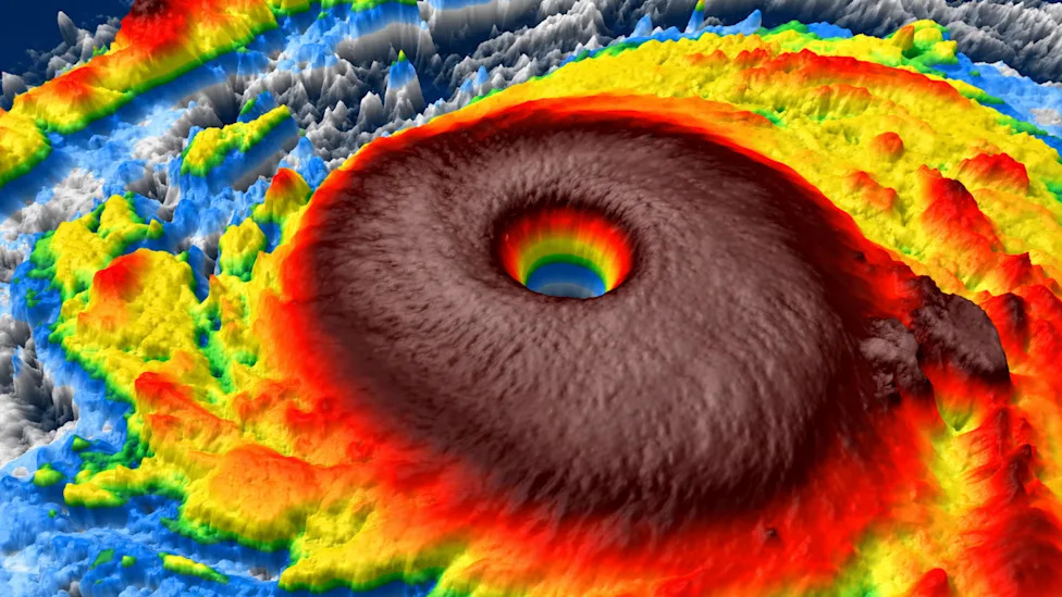
Super typhoon champi has emerged as a Category 5-equivalent monster in the western Pacific, packing sustained winds of up to 185 mph as it moves toward East Asia. The massive system, which has been traversing the Philippine Sea, is currently posing a significant threat to the Ryukyu Islands, Okinawa, and northern taiwan, with a projected path that could eventually bring landfall to the east coast of mainland China.
Key Takeaways
- Extreme Intensity: Champi reached peak sustained winds of 185 mph, tying it with Super Typhoon Sinlaku as the strongest storm of 2026.
- Regional Threats: The storm is moving west-northwest toward Taiwan and Okinawa, prompting major maritime and aviation disruptions.
- Guam Impact: While the eye passed 10 miles south of Guam, the island faced significant operational shutdowns, including the closure of airports and medical facilities.
- Economic Disruption: Major carriers like China Airlines and Tigerair Taiwan have implemented widespread flight cancellations, and vital shipping lanes in the Taiwan Strait are being cleared.
- Military Response: The “Keen Sword” joint military training exercises have been scaled back to prioritize safety in response to the storm’s trajectory.
- October 24, 2026: The storm is forecast to make landfall on the east coast of mainland China, potentially impacting areas near Shanghai.
- www.yahoo.com
- en.as.com
- www.washingtonpost.com
What Happened: The Rise of a Category 5 Giant
Super Typhoon Champi began its lifecycle as a tropical depression near Micronesia on October 11, 2026. By October 14, the system was officially classified as “29W,” the 29th recognized system in the western Pacific. Over the following week, the storm underwent rapid intensification, fueled by ideal atmospheric conditions.
According to Matthew Cappucci and Ben Noll of the Washington Post, the system has been “taking advantage of ideal conditions for tropical cyclone sustenance and strengthening.” These conditions included sea surface temperatures ranging between 86 and 88 degrees Fahrenheit and weak upper-level winds that prevented the storm’s structure from being disrupted.
By the weekend of October 18-19, Champi had reached high-end Category 5 strength. It skirted the southern tip of Guam, passing approximately 10 miles to the south. During this proximity, winds near the storm’s core were measured at approximately 150 mph. On Monday and Tuesday, the storm underwent further intensification, peaking with sustained winds of 185 mph and gusts nearing 215 mph. This level of intensity makes the storm’s wind field equivalent to a 50-mile-wide EF4 tornado.
As of October 21, 2026, the National Weather Service (NWS) reports that the storm is moving west-northwest at 15 mph. While its maximum sustained winds have recently been recorded at 175 mph, it remains a high-priority Category 5 threat as it approaches the Ryukyu Islands and Taiwan.
Why It Matters: Regional and Global Implications
The sheer scale and power of Super Typhoon Champi have far-reaching implications for regional security, international commerce, and human safety. Unlike smaller tropical systems, Champi’s massive wind field and eyewall pose severe threats to maritime lanes and coastal communities across the western Pacific.
Maritime and Economic Disruption
One of the most immediate impacts is the disruption of vital shipping lanes. Both mainland China and Taiwan authorities have ordered ships to clear key maritime routes to prevent vessel loss or accidents during the storm’s passage. Given the importance of the Taiwan Strait to global trade, the clearing of these lanes represents a significant, albeit necessary, logistical hurdle for international supply chains.
Aviation and Travel Chaos
The aviation sector in East Asia is facing substantial turbulence. Major airlines have been forced to cancel numerous flights to ensure passenger safety and avoid grounding aircraft in extreme wind conditions.
| Airline | Flight Numbers | Status | Route/Region |
|---|---|---|---|
| China Airlines | CI122/CI123 | Cancelled | Taoyuan to Okinawa |
| China Airlines | CI312/CI313 | Cancelled | Taichung to Okinawa |
| China Airlines | CI132/CI133 | Cancelled | Kaohsiung to Okinawa |
| Tigerair Taiwan | IT232/IT233 | Cancelled | Taoyuan to Okinawa |
| Tigerair Taiwan | IT289/IT728 | Cancelled | Kaohsiung to Okinawa |
| Tigerair Taiwan | IT793 | Cancelled | Okinawa to Taichung |
| Tigerair Taiwan | IT796 | Cancelled | Tainan to Okinawa |
Military and Governmental Response
The storm has also necessitated a shift in regional military posture. The “Keen Sword” joint military training exercises, involving U.S. and Japanese forces, have been scaled back. Major Ephesian Poisette, a spokesman for the Keen Sword drill, stated that “safety remains our absolute priority” in light of the storm’s path.
In Guam, although Governor Lou Leon Guerrero reported “relatively minimal damage” physically, the operational impact was severe. Local officials were forced to close airports, ports, and several medical facilities. The scale of the potential impact prompted the authorization of federal emergency assistance for the region.
Meteorological Deep-Dive: The Anatomy of Champi
To understand the danger Champi poses, one must look at its unique meteorological structure. Meteorologists at Fox Weather described the system as an “absolute planetary powerhouse,” noting that its massive wind field poses severe threats to both maritime and coastal sectors.
The Eye and Eyewall
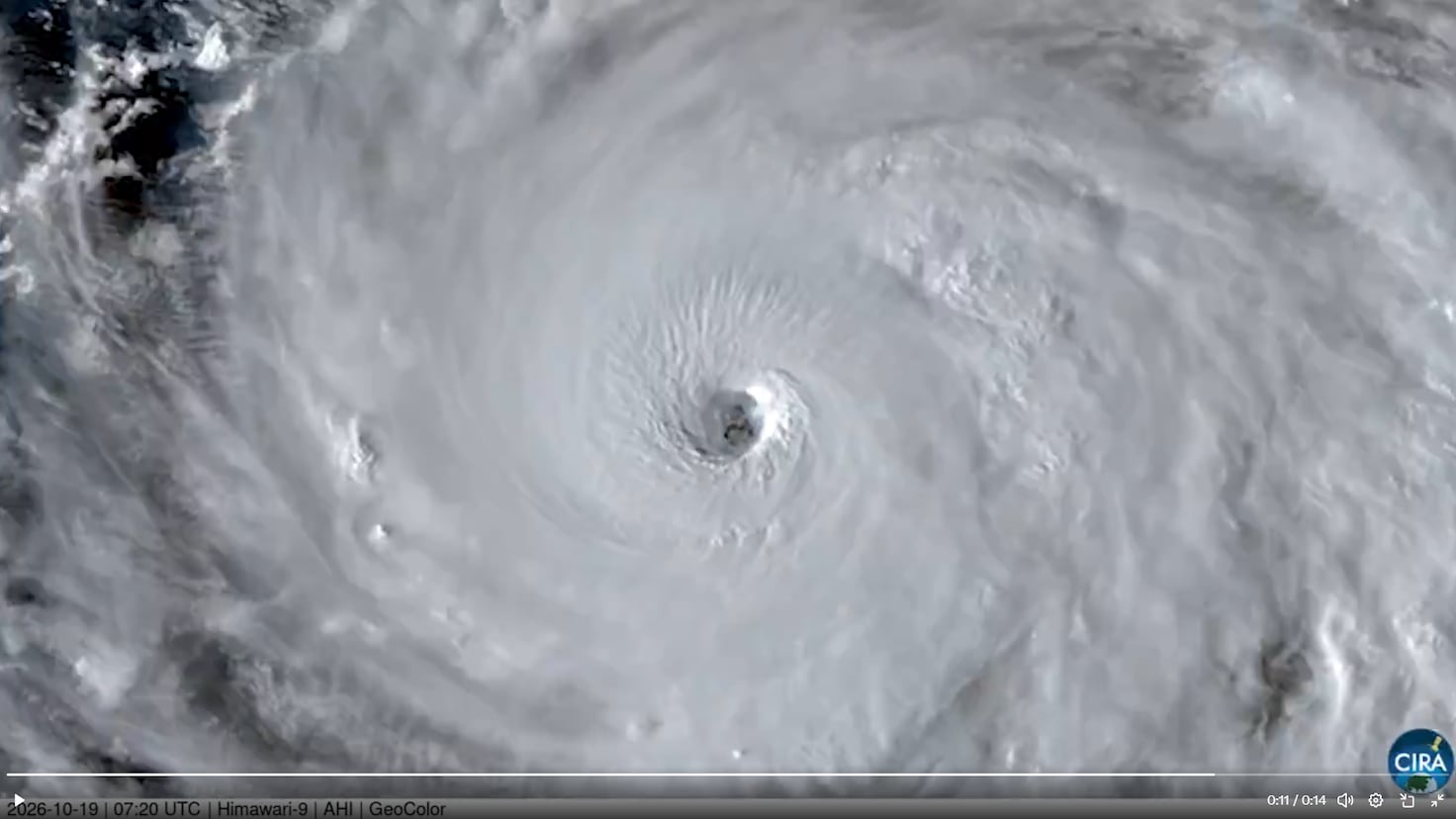
There has been significant discussion regarding the size of Champi’s eye. While some early reports and historical comparisons suggested a “Rhode Island-sized eye,” the Surfer outlet clarified that this description actually referred to a different iteration of a Typhoon Champi from 2015. Current National Weather Service measurements place the eye of the 2026 storm at approximately five to six miles wide.
However, while the eye is relatively compact, the eyewall is gargantuan. Reports from AS USA describe the eyewall as being “nearly 2 Mount Everests tall and 1.2 Rhode Islands wide.” This massive eyewall is where the most violent winds reside. Satellite imagery has even captured mesovortices—smaller eddies and whirls—within the eye, which assist the atmosphere in transitioning from the extreme ferocity of the eyewall to the calm center.
Comparative Intensity
Champi’s 185 mph peak winds place it in an elite tier of tropical cyclones. It currently ties with Super Typhoon Sinlaku for the highest peak wind speed recorded in 2026. It also outstrips Hurricane Polo, which held the second-highest peak wind speed of the year. To put this in perspective, the strongest storm in the North Atlantic in 2026 reached only 120 mph, highlighting the extreme volatility and power of the western Pacific storm season.

What It Means for You
Depending on your location and professional sector, the progression of Super Typhoon Champi will require specific precautions:
For Residents in Taiwan, Okinawa, and the Ryukyu Islands: Expect heavy rainfall, torrential flooding, and dangerous surf. Authorities urge residents to finalize emergency plans, secure loose outdoor objects, and monitor local weather advisories from the Central Weather Administration and the Japan Meteorological Agency.
For Travelers: If you have upcoming flights involving Taoyuan, Kaohsiung, Taichung, or Okinawa, expect significant delays or cancellations. Check with China Airlines, Tigerair Taiwan, or Nippon Airways frequently for updated schedules.
For Maritime and Logistics Professionals: Be aware of the mandatory clearing of shipping lanes in the Taiwan Strait and the Philippine Sea. Expect delays in regional port operations and potential rerouting of cargo vessels.
For Investors in East Asian Markets: The storm’s impact on manufacturing hubs in Taiwan and China, as well as potential disruptions to semiconductor-related shipping, may cause short-term volatility in regional trade-related sectors.
Counterpoints and Open Questions
While the primary threat is the wind and rain, there are several nuances and uncertainties that meteorologists are still working to resolve.
Model Disagreement and Forecast Uncertainty
There is currently a degree of uncertainty regarding the broader Pacific storm season. While Champi is a clear and present danger, a second system, designated 94E, is forming in the eastern Pacific near Mexico. The FOX Forecast Center has noted “considerable disagreement” among forecast models regarding the timing and trajectory of 94E. If 94E develops into a tropical storm and receives the name Vance, it would mark a record-breaking year for the eastern Pacific, as it would be the first “V” named storm since Vicente in 2018.
The Question of Landfall Intensity
A point of potential relief for those in East Asia is the forecast that Champi will begin to weaken as it approaches land. However, the risk remains high; even a weakening Category 4-equivalent storm can cause catastrophic damage through flooding and storm surges. The exact timing of the storm’s closest approach to Taiwan and its eventual landfall on mainland China remains subject to change as the system interacts with landmasses.
What Happens Next
As Super Typhoon Champi continues its west-northwest trek, the following timeline is projected by meteorological agencies:
October 22, 2026: The storm is expected to turn more toward the north and begin a gradual weakening phase. Taiwan is expected to issue formal land warnings.
October 23, 2026: Champi is projected to reach the Sakishima Islands and make its closest approach to the shores of Taiwan.
Authorities in South Korea and mainland China are currently on high alert, monitoring the storm’s potential to bring significant weather impacts to their coastal regions later this weekend.
Frequently Asked Questions
How strong is Super Typhoon Champi?
Super Typhoon Champi is a Category 5-equivalent storm. It reached peak sustained winds of 185 mph, making it one of the strongest tropical cyclones of 2026, tied with Super Typhoon Sinlaku.
What is the difference between the eye and the eyewall of Champi?
The eye is the relatively calm center of the storm, measured at approximately five to six miles wide in the current 2026 iteration. The eyewall is the ring of intense weather surrounding the eye; Champi’s eyewall is exceptionally large, described as being nearly two Mount Everests in height.
Has Champi already caused damage?
While Champi has not yet made a direct landfall on a major landmass, it has caused significant operational disruptions. Guam experienced airport and port closures, and several airlines in the East Asian region have canceled numerous flights. Federal aid has been authorized for Guam to assist with the regional impact.
Will the storm hit mainland China?
According to current forecasts, Champi is projected to make landfall on the east coast of mainland China on approximately October 24, 2026, after passing near Taiwan and the Sakishima Islands.
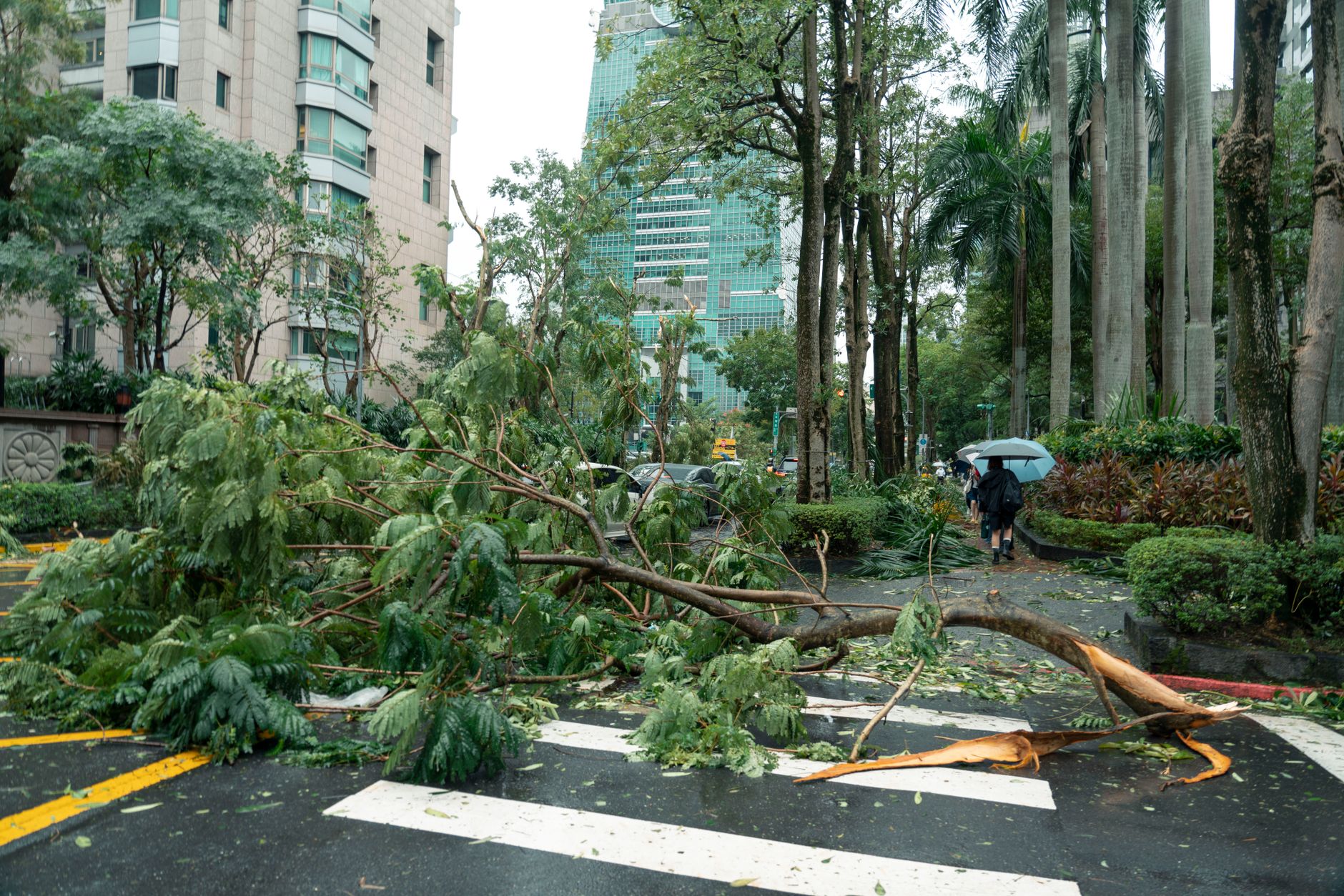
Super Typhoon Champi remains a volatile and powerful system
References
Featured image: Image via Yahoo News