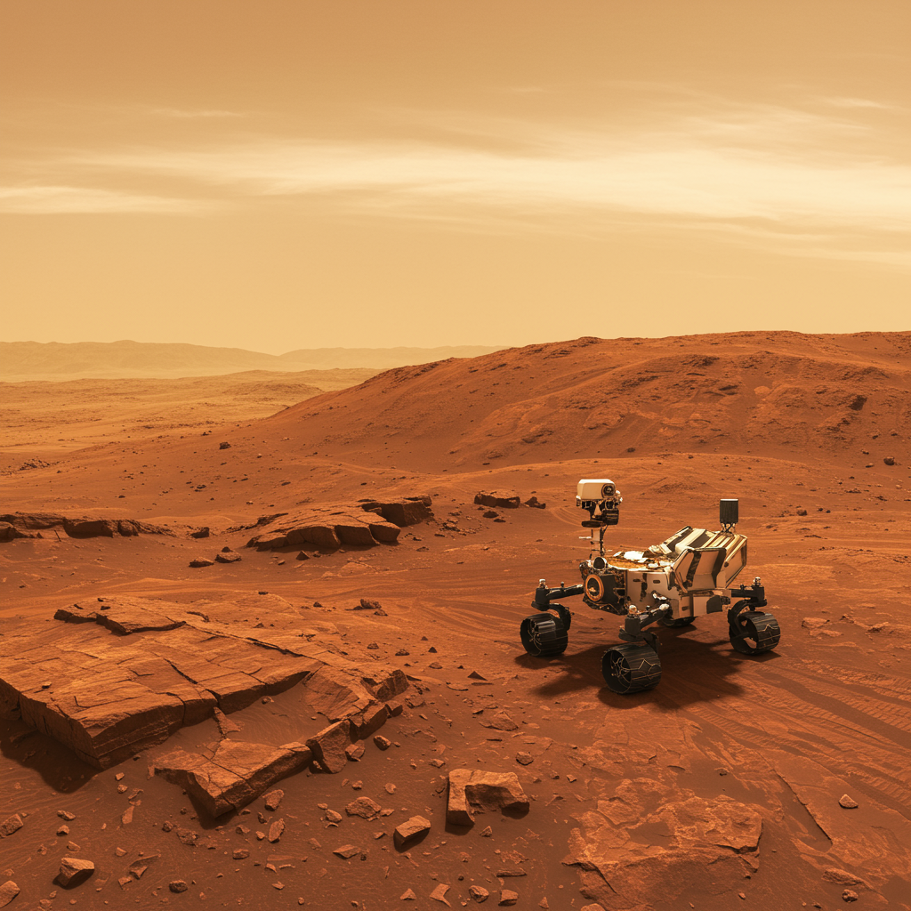
NASA’s Curiosity Rover: Exploring Ancient Geology and Watching Mars’ Atmosphere
NASA’s Curiosity Mars rover continues its vital mission on the Red Planet, currently investigating the fascinating boxwork structures found high on the slopes of Mount Sharp. These distinctive geological formations, alongside linear features thought to be evidence of ancient groundwater flow, are key targets in the search for clues about Mars’ warmer, wetter past.
Having recently completed a successful drive into the informal ‘Uyuni’ quadrangle—named after a town near Bolivia’s vast salt flats, reflecting the drier environments now being explored—Curiosity is strategically positioned within a trough cutting through a fractured region. This terrain, characterized by shallow depressions separated by raised ridges, presents potential opportunities to study bedrock composition and structure up close, including assessing areas that could be candidates for future drilling operations. The mission utilizes target names themed around the namesake town and nearby regions like Chile’s Atacama Desert, itself a valuable Mars analog site on Earth.
While the rover navigates this boxwork landscape, comparing it perhaps to the exploratory spirit seen in other Mars missions like Perseverance searching for ancient, water-formed clay minerals in Jezero Crater, Curiosity’s latest plan highlights a shift in focus: looking up at the Martian skies.
Prioritizing Atmospheric Investigations
For Sols 4577-4579 (corresponding to Earth dates around June 20-22, 2025), Curiosity’s science schedule has been adjusted to give increased time to atmospheric observations. This comes as a planned frost-detection experiment is temporarily postponed due to a known issue with the ChemCam instrument. The atmospheric investigations provide crucial data on Mars’ current climate, complementing the geological studies of its ancient environment.
Key atmospheric activities planned include:
Cloud Studies: Using the navigation cameras (Navcam) to capture movies of cloud shadows moving over Mount Sharp’s upper reaches. This helps scientists calculate cloud altitudes. Navcam will also image clouds directly overhead (at zenith) to determine wind direction higher in the atmosphere.
Sky Surveys: Conducting a 360-degree Navcam sky survey to study the scattering of light across the entire sky.
Dust Monitoring: Performing Mastcam and Navcam observations to measure dust opacity in the atmosphere, including a Navcam measurement across Gale Crater.
Dust Devil Watch: Carrying out a Navcam dust-devil survey to track these common Martian phenomena.
Geological Close-Ups and Remote Sensing
Alongside watching the skies, Curiosity is busy documenting its immediate surroundings and selecting targets for detailed analysis. The Mastcam instrument is taking multiple stereo mosaics to build 3D views of the workspace and specific features within the trough.
Notable geological targets include:
Copacabana: A representative sample of the trough bedrock, named after a town on Lake Titicaca. Curiosity will use its Dust Removal Tool (DRT) to brush dust off this spot, then image it with the Mars Hand Lens Imager (MAHLI) before the Alpha Particle X-ray Spectrometer (APXS) analyzes its chemical composition overnight.
Copiapo: A section of lighter-toned material, potentially part of the mineral veins filling the many crosscutting fractures in the rocks. These veins are strong candidates for deposits left behind by ancient groundwater. Like Copacabana, it will be imaged by MAHLI and analyzed by APXS after brushing. This target is named for a city in Chile’s Atacama Desert, linking back to the quadrangle’s theme.
Active Cracks: Mastcam mosaics are capturing images of fissures within the trough, allowing scientists to study ongoing surface processes.
Ardamarca Ridge: A target on a ridge running parallel to the trough walls, also imaged by Mastcam.
- Mishe Mokwa Butte: While located back in the previously explored ‘Altadena’ quadrangle, a cliff face at the base of this butte, exposing layers of rock, remains a feature of interest and is being imaged by Mastcam.
- science.nasa.gov
- science.nasa.gov
- science.nasa.gov
- science.nasa.gov
- science.nasa.gov
Early on Sol 4578, large Mastcam mosaics will be taken to capture different parts of the trough, using the morning light to highlight terrain shadows and geological textures.
Driving Forward
Following these extensive observations, Curiosity is scheduled for a relatively short 25-meter (about 82 feet) drive. Post-drive imaging will include a 360-degree Navcam panorama of the new location and an image of the ground directly under the rover using the Mars Descent Imager (MARDI) in the evening twilight.
Looking ahead, the team anticipates planning another drive early next week and hopes to resume the frost-detection experiment soon as Curiosity continues its detailed exploration of the intriguing boxwork canyons and seeks further evidence of Mars’ ancient watery past.