A monumental collaboration between two global space powerhouses, NASA (United States) and ISRO (India), is set to launch the NISAR satellite – a project valued at an estimated $1.5 billion. Poised to lift off from India’s Satish Dhawan Space Centre in June 2025, this advanced Earth observation satellite promises to revolutionize our understanding of the planet’s dynamic surface.
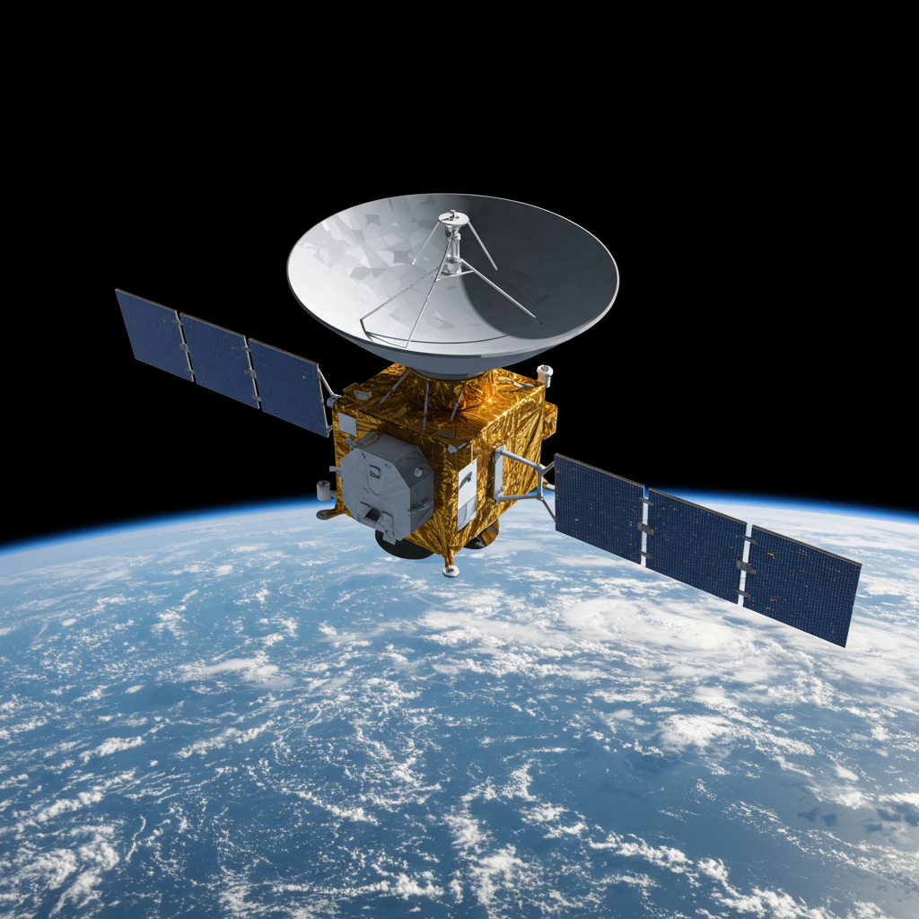
Weighing nearly 3 tonnes and featuring a massive 12-meter radar antenna, the NISAR (NASA-ISRO Synthetic Aperture Radar) satellite is designed to provide unprecedented detail on changes occurring on Earth, monitoring land, water, and ice with remarkable precision. Its capabilities are expected to deliver critical data for scientists, farmers, and emergency responders worldwide.
Overcoming Limitations with SAR Technology
Traditional Earth observation satellites often rely on visible light, meaning they can only capture images during the daytime and when skies are clear. This presents significant challenges in regions with frequent cloud cover or when nighttime monitoring is essential, such as during natural disasters.
NISAR bypasses these limitations by utilizing cutting-edge Synthetic Aperture Radar (SAR) technology. Unlike passive optical systems, SAR actively transmits radar signals towards Earth and measures the reflection. This technique, similar to using a camera flash in the dark, allows NISAR to image the planet day or night, penetrating clouds, smoke, and ash that would obscure traditional sensors. This all-weather, all-day capability is invaluable for continuous monitoring and rapid assessment, especially during crises like floods or volcanic eruptions.
A Dual-Frequency First for Unmatched Detail
What truly sets NISAR apart is its pioneering use of two complementary radar frequencies: L-band and S-band. While other SAR satellites, like the European Space Agency’s Sentinel-1, use a single frequency, NISAR’s dual approach enables the collection of richer, more nuanced data.
The L-band, provided by NASA, penetrates further into vegetation and soil, offering insights into forest structure, biomass, and subsurface conditions.
The S-band, contributed by ISRO, provides different perspectives on surface scattering properties, enhancing capabilities for monitoring surface changes and detecting water.
Working in tandem, these frequencies allow NISAR to detect tiny shifts in Earth’s surface height – changes as small as a few centimeters, or even millimeters. This centimeter-level precision makes NISAR a powerful tool for monitoring land deformation caused by earthquakes, landslides, volcanic activity, or even tracking the subsidence of structures like dams and mapping groundwater levels.
Revolutionizing Environmental Monitoring and Disaster Response
The high-resolution data NISAR will collect globally, freely and openly available every 12 days, will fuel a wide range of applications:
Environmental Science: Detailed monitoring of forest biomass, mapping flooded vegetation in crucial wetland ecosystems (vital for carbon storage and biodiversity), tracking the flow of ice sheets and glaciers, and monitoring coastal erosion.
Disaster Management: Rapid and accurate mapping of disaster-affected areas, providing response teams with critical information on ground movement and damage after earthquakes or volcanic eruptions, and helping track the extent of floods or bushfires even through smoke.
- Agriculture: High-resolution soil moisture estimation in all weather conditions. This data can help farmers optimize irrigation, conserve water, and potentially improve crop yields.
- www.sciencealert.com
- timesofindia.indiatimes.com
- arstechnica.com
- science.nasa.gov
- spaceflightnow.com
A Symbol of Growing Space Collaboration
The NISAR mission is more than just an advanced satellite; it’s a testament to the growing strategic partnership between the US and India in space exploration. The collaboration, formalized by an agreement in 2014, sees NASA contributing the L-band SAR instrument, a high-rate telecommunication subsystem, GPS receivers, and data systems, while ISRO provides the satellite bus, the S-band SAR instrument, the launch vehicle (GSLV Mk II), and launch services.
NISAR’s launch in June 2025 is one of several high-profile missions planned by ISRO, including sending an Indian astronaut to the International Space Station as part of a NASA-collaborated mission. These initiatives highlight India’s ambitious drive to expand its space capabilities significantly and emerge as a major player on the global space stage, aiming to become the world’s third-largest space power in the coming years.
NISAR represents a significant leap forward in Earth observation technology. By providing unprecedented detail and reliable data regardless of weather or time, this ambitious $1.5 billion mission is set to deliver immense benefits for scientific research, environmental protection, disaster preparedness, and sustainable resource management for years to come.