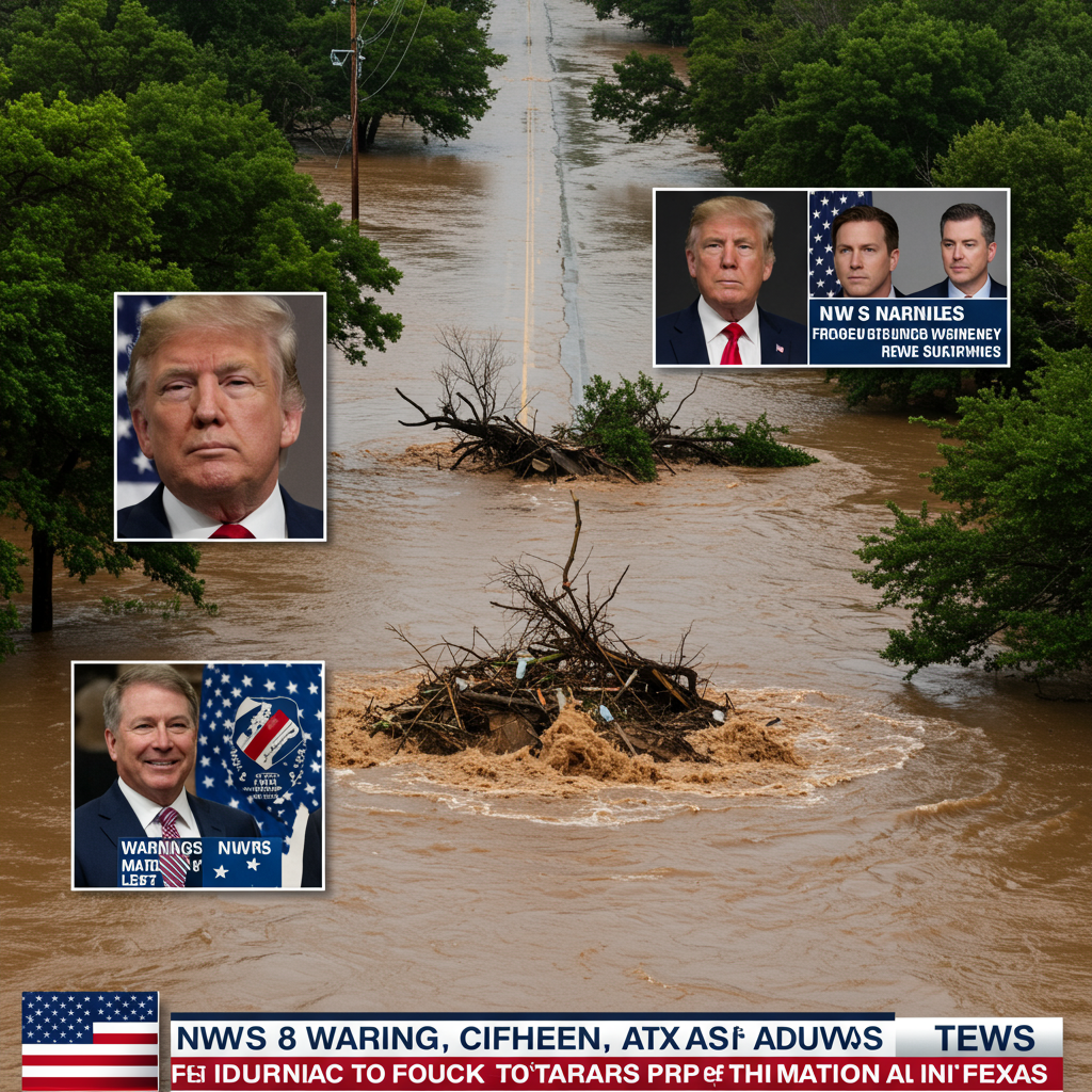
Catastrophic flash floods ripped through texas over the Independence Day weekend, claiming at least 79 lives and leaving many more missing. As search efforts continue amidst devastating destruction, a fierce debate has ignited: were the National Weather Service (NWS) warnings adequate, and did previous staff cuts under the Trump administration play a role in the tragedy? The NWS and White House have fiercely defended their actions, while experts and local officials offer conflicting perspectives on forecasting limitations, warning dissemination, and the long-term impact of resource reductions.
The sudden deluge struck the Texas Hill Country, an area tragically nicknamed “flash flood alley,” during the early morning hours of Friday. Within hours, floodwaters surged, catching residents and campers off guard and overwhelming communities, particularly in Kerr County. Some Texas officials quickly voiced criticism, suggesting NWS forecasts underestimated the severity and amount of predicted rainfall. Nim Kidd, Chief of the Texas Division of Emergency Management, pointed to earlier forecasts predicting only 3-8 inches, starkly contrasting with the significantly higher amounts that fell in localized areas. Kerr County Judge Rob Kelly stated they had “no reason to believe that this was going to be anything like what’s happened here.”
In stark contrast, other local leaders, including Travis County Judge Andy Brown and emergency coordinator Eric Carter, expressed gratitude for timely and proactive alerts from the NWS. The agency itself issued a detailed statement defending its actions and providing a timeline of warnings. They highlighted issuing a flood watch for parts of south-central Texas, including Kerr County, on Thursday afternoon, effective into Friday morning. Critically, an urgent flash flood warning for Kerr County was issued at 1:14 a.m. CT on Friday, three hours before the first reports of rising water. This warning included “considerable” or “catastrophic” tags intended to trigger wireless emergency alerts on mobile devices. The NWS and the White House pushed back hard against criticisms, calling claims that staff cuts contributed “disgusting” and “false.”
Expert Analysis: Forecast Limitations vs. Reality
Independent meteorologists and former NWS officials largely supported the NWS’s defense concerning the accuracy and timeliness of warnings for this specific event, given the inherent scientific challenges. They emphasize that predicting extreme rainfall and flash flooding beyond a few hours is notoriously difficult. This specialized task, known as Quantitative Precipitation Forecasting (QPF), requires pinpointing not just the general threat but the exact location, amount, and timing of intense rain — a capability that current science has limitations on, especially for highly localized events fueled by tropical moisture, like the one over Texas.
Meteorologists like Chris Vagasky noted that while forecasters were aware a significant event was possible and messaged that concern, precisely predicting where the heaviest rain would fall — a few miles here or there — has a massive impact on flooding but remains scientifically challenging. Alan Gerard, a former NOAA official, reviewed the NWS Austin/San Antonio office’s performance and found the warning services provided during the event were “solid” and met public expectations, despite some specific leadership vacancies. Matt Lanza, a Houston-based meteorologist, also saw no initial evidence linking staffing levels to the immediate forecast quality for this tragedy.
Scrutiny on NWS Staffing Cuts
Despite defenses of the warnings issued for this event, significant concerns surrounding broader NWS staffing levels and the impact of recent cuts remain a key part of the conversation. Under the Trump administration, the NWS saw substantial reductions, losing approximately 600 employees by early June through layoffs, buyouts, and early retirements. These cuts affected both veteran workers and newer staff. Some offices nationally experienced staffing reductions exceeding 40%, leading to at least eight ceasing 24/7 operations and the suspension of some crucial weather balloon launches.
In May, over 40% of the country’s weather forecasting offices had vacancy rates above 20%. The National Weather Service Employees Organization legislative director, Tom Fahy, confirmed that the San Antonio office, while having adequate meteorologists (11 staff) to issue immediate warnings, was down six employees from its typical full staffing level of 26. More concerning were key leadership positions like permanent Science Officer and Warning Coordination Meteorologist remaining unfilled, although acting personnel were in place. The nearby San Angelo office, also involved in warnings, was short four staff from its usual 23, lacked a permanent Meteorologist-in-Charge, and critically, had no hydrologist — a role vital for flood response.
Broader Concerns and Future Impact
The impact of these national staffing issues goes beyond the immediate event response. All living former directors of the NWS penned a letter expressing deep concern that understaffing could lead to “needless loss of life” in the future. While most experts quoted didn’t blame cuts for the initial forecast accuracy in this specific case, they highlighted other potential impacts. Rick Spinrad, a former NOAA administrator, noted that chronic understaffing puts an “extra burden” on employees and warned that reduced staff and research funding would “undoubtedly… degrade” future prediction capabilities across various weather events.
Meteorologist John Morales, while defending the accuracy of the anticipatory warnings for this event, suggested that unfilled management positions could hinder the NWS’s ability to effectively coordinate with local emergency management after disaster strikes. Furthermore, experts like Chris Vagasky raised alarms about the administration’s proposed budget requests potentially shutting down NOAA research labs, which are essential for improving complex forecasting areas like QPF – precisely the science needed to better predict future extreme rain events like the one that devastated Texas.
The “Last Mile”: Getting the Message Out
Even with timely forecasts and warnings, a critical challenge in saving lives during rapid-onset events like flash floods is ensuring the message reaches and is heeded by those most at risk. Experts repeatedly cited the “last mile” problem – the difficulty in disseminating urgent alerts effectively, especially during overnight hours when most people are asleep. The Texas floods occurred early Friday morning, a “nightmare scenario” for forecasters trying to warn sleeping populations who cannot see rising water.
Questions remain about how well wireless emergency alerts were received and whether people had them enabled. Local officials in Kerrville acknowledged they would review their own emergency notification systems to determine if they were robust enough to warn residents adequately. Kerrville City Manager Dalton Rice indicated a full review of local events and systems is planned to strengthen future preparedness. The confluence of a difficult-to-pinpoint forecast, the challenging overnight timing, and potential gaps in local warning reception or public response appears to be a significant factor contributing to the tragic outcome, even as the debate over NWS staffing continues.
climate Change Context
Adding another layer to the discussion, climate experts emphasize the link between such extreme rainfall events and climate change. They agree that events like the Texas floods are expected to become stronger and more frequent in a warming world. A warmer atmosphere holds significantly more moisture, increasing the potential for intense downpours.
According to Climate Central, the moisture fueling the Texas storm originated from a warmer-than-average Gulf of Mexico, with sea temperatures 1-2°F above average. Climate Central estimates these warmer temperatures are 10 to 30 times more likely due to climate change. UCLA climate scientist Daniel Swain stated that “record-shattering rain” from slow-moving thunderstorms is exactly the type of event increasing fastest due to warming, concluding that it’s not a question of if climate change played a role, but how much. This broader context underscores the increasing stakes for accurate forecasting and effective warnings as extreme weather becomes more probable.
The search for the missing continues in Texas, and communities grapple with the devastation. While the immediate controversy focuses on the NWS warnings and staffing cuts, the tragedy highlights a complex interplay of factors: the inherent difficulty of forecasting intense, localized flash floods, the crucial challenge of ensuring warnings reach everyone, the very real concerns about the long-term health and capacity of the nation’s weather service amidst budget constraints, and the undeniable influence of a changing climate on extreme weather patterns.
Frequently Asked Questions
Why is predicting flash floods like the one in Texas so difficult?
Predicting flash floods is extremely challenging because it involves forecasting precise amounts of rain, their exact location, and the timing of intense downpours (known as Quantitative Precipitation Forecasting or QPF). Unlike broader storms, flash floods are triggered by highly localized, sudden bursts of extreme rainfall that can overwhelm riverbeds and terrain rapidly, especially in areas like the Texas Hill Country. Current scientific models struggle to pinpoint these elements with high precision more than a few hours in advance.
Did NWS staffing cuts directly cause the deaths in the Texas floods?
While there are significant concerns about national NWS staffing levels and vacancy rates following recent cuts, most meteorologists quoted in expert analyses stated there was no direct evidence these specific cuts prevented the initial accurate and timely issuance of flash flood warnings for this event. However, concerns remain that reduced staffing and unfilled key positions (like hydrologists or Warning Coordination Meteorologists) could negatively impact post-event coordination with local officials or future research needed to improve forecasting capabilities.
How did climate change potentially influence these Texas floods?
Climate experts agree that extreme rainfall events like the one in Texas are becoming more likely and intense due to climate change. A warmer atmosphere holds more moisture, increasing the potential for heavier precipitation during storms. Scientists noted that the moisture feeding this specific storm came from a warmer-than-average Gulf of Mexico, a condition estimated to be significantly more probable because of global warming, directly linking the event’s intensity to the changing climate.