tropical storm Chantal made landfall in South carolina early Sunday, July 6, 2025, arriving near Litchfield Beach. This third named storm of the Atlantic season brought sustained winds and heavy rainfall to the region. Residents and visitors across the coastal Carolinas faced potential hazards, including flash flooding and dangerous rip currents, prompting officials to issue tropical storm warnings for areas stretching into North Carolina. The storm is expected to weaken quickly as it pushes inland, though impacts like localized flooding and gusty winds will continue throughout the day.
Tropical Storm Chantal Makes Landfall Sunday Morning
The arrival of Tropical Storm Chantal marked a significant weather event for the Southeast United States. Landfall occurred around 4 a.m. on Sunday, July 6, 2025, specifically near Litchfield Beach, South Carolina. According to the National Hurricane Center, the storm’s center was initially located about 70 miles northeast of Charleston.
Prior to hitting the coast, Chantal had slightly strengthened. At 2 a.m. Sunday, observations showed maximum sustained winds had increased to 60 mph. However, by about an hour after making landfall, the storm’s sustained winds had decreased to approximately 50 mph. Despite the reduction in wind speed, the storm maintained a steady northward movement at about 8 mph. This speed and direction determined which areas felt the primary impacts.
Warnings and Expected Impacts
Authorities had proactively issued tropical storm warnings along portions of the coast. These warnings covered the area from the South Santee River in South Carolina northward to Surf City, North Carolina. Notable locations within this warning zone included Myrtle Beach, South Carolina. In these warned areas, peak winds were anticipated to reach between 20-30 mph, with gusts possibly climbing to 45 mph.
Conditions offshore prompted warnings well before Tropical Storm Chantal reached the shore. As Chantal churned off the southeastern U.S. coast on Saturday, warnings were already in place extending into North Carolina. Officials also noted that a tropical storm watch that had previously covered the area from Edisto Beach to the South Santee River, including Charleston, South Carolina, had been discontinued as the storm’s track became clearer.
Heavy Rain and Flooding Concerns Take Center Stage
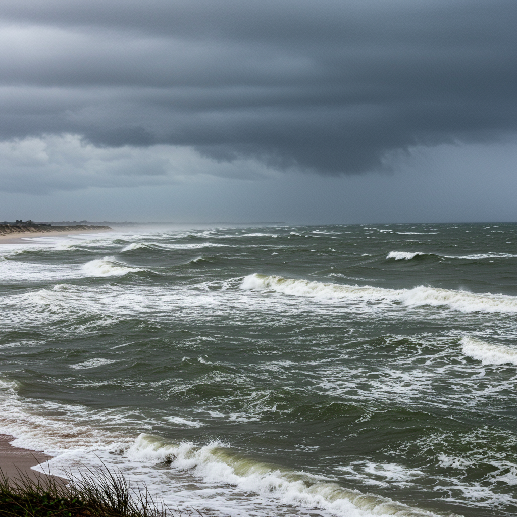
While winds were a factor, heavy rainfall emerged as a primary concern with Tropical Storm Chantal. Forecasters consistently highlighted the potential for significant precipitation across the coastal Carolinas. Widespread storm total rainfall amounts of 2 to 4 inches were expected across the Carolinas through Monday. Importantly, localized areas where the heaviest rainbands persisted could see higher totals, potentially reaching up to 6 inches.
This volume of rain carried a significant risk of flash flooding. Flood Watches were issued for multiple areas, extending from Myrtle Beach westward to areas west of Wilmington, North Carolina, valid through Sunday night. Inland communities were also under alert, with parts of inland North Carolina, including Fayetteville and Raleigh, under Flood Watches until Monday. Authorities strongly cautioned against driving through water or bypassing road closure signs due to the inherent danger of flooded roads.
Other Hazards Associated with the Storm
Tropical cyclones, even weaker ones like Tropical Storm Chantal at landfall, bring a range of dangers beyond wind. One notable characteristic of Chantal was its lopsided nature. Experts indicated that the most significant rain and wind impacts were expected to occur on the storm’s right side relative to its direction of motion. This meant areas to the east of the storm’s center were likely to experience the most intense weather.
Rainbands from Chantal were already spreading inland before landfall. Scattered showers and thunderstorms from the storm’s outer bands impacted inland portions of South and North Carolina. More concentrated rain and thunderstorms from the inner bands moved inland from the coastline as the storm progressed.
Coastal areas faced additional threats. Minor storm surge was anticipated, potentially causing normally dry areas near the coast to be inundated by rising waters. Forecasts suggested 1 to 3 feet of storm surge was possible for coastal regions under the tropical storm warning, particularly during high tide cycles.
Furthermore, the rough surf generated by the storm posed a serious risk. Life-threatening rip currents were expected to affect the coast from northeastern Florida all the way up to the Mid-Atlantic states over the following day or so. Lifeguard organizations along the Grand Strand in South Carolina had already reported performing rescues due to dangerous ocean conditions. There was also a risk of isolated tornadoes forming on Sunday across portions of eastern North Carolina and extreme northeastern South Carolina, a hazard often associated with tropical systems.
What Comes Next for Chantal
Following Tropical Storm Chantal‘s landfall, the forecast indicates a period of rapid weakening. As the storm interacts with land and loses its connection to the warm ocean waters that fueled it, its intensity will decrease. Chantal is expected to likely weaken into a tropical depression later on Sunday. The system is then projected to dissipate entirely by Monday.
Despite the weakening trend, remnants of Chantal will continue to influence the weather across the affected areas. Scattered showers and thunderstorms are forecast to persist throughout Sunday. These will include locally heavy rain, maintaining the threat of localized flooding, alongside gusty winds. Residents should continue to monitor local weather forecasts and heed any remaining warnings from authorities.
Context of the Atlantic Hurricane Season
Tropical Storm Chantal’s formation and landfall in early July placed it somewhat ahead of the typical schedule for the Atlantic hurricane season. The National Hurricane Center notes that the third named storm of the Atlantic season usually forms around August 3rd on average. This early activity serves as a reminder that the hurricane season, which runs from June 1 to November 30, is well underway. Staying informed about tropical weather developments and having a preparedness plan is essential for those living in or visiting coastal regions during this time.
Preparing for Inland Impacts
Even as Chantal weakens inland, the primary threat shifts to residual heavy rain and flooding. It’s crucial for communities experiencing rainfall from the storm’s remnants to remain vigilant. Flash flooding can develop quickly, even in areas not directly on the coast.
Residents should:
Avoid flooded areas and never drive or walk through floodwaters.
Monitor local radar and flood alerts.
Secure any loose outdoor items that could be affected by residual gusty winds.
Have a communication plan with family in case of power outages.
Understanding the specific risks in your location, whether coastal or inland, is key to staying safe during and after a tropical storm event.
Frequently Asked Questions
What were the main impacts expected from Tropical Storm Chantal after landfall?
After Tropical Storm Chantal made landfall near Litchfield Beach, South Carolina, early Sunday, July 6, 2025, the primary expected impacts included heavy rainfall leading to potential flash flooding across the Carolinas. Other significant concerns were gusty winds, especially in areas under the tropical storm warning, minor storm surge along the coast during high tide, life-threatening rip currents, and the risk of isolated tornadoes in parts of eastern North Carolina and northeastern South Carolina. The storm’s lopsided structure meant heavier rain and winds were expected on its right side.
Where were tropical storm warnings issued for Tropical Storm Chantal?
Tropical storm warnings were issued for portions of the South Carolina and North Carolina coast. Specifically, the warning area extended from the South Santee River in South Carolina northward to Surf City, North Carolina. This zone included popular coastal areas like Myrtle Beach, South Carolina. These warnings indicated that tropical storm conditions, including strong winds and heavy rain, were expected in these locations. A previous watch for areas south of the South Santee River, including Charleston, was discontinued.
What safety precautions should I take during Tropical Storm Chantal’s inland movement?
As Tropical Storm Chantal moves inland and weakens, the main threat often becomes flooding from heavy rainfall. It is critical to avoid driving or walking through floodwaters, as they can be deeper and more dangerous than they appear. Monitor local flood watches and warnings, especially in areas like Fayetteville and Raleigh in North Carolina. Secure outdoor objects against potential residual gusty winds. Be aware of continued risks like life-threatening rip currents at the coast. Always follow instructions from local emergency management officials.
Conclusion
Tropical Storm Chantal’s early Sunday landfall brought anticipated wind and rain impacts to the South Carolina coast and surrounding areas. While the storm is expected to weaken rapidly as it moves inland, the threat of heavy rainfall and subsequent flash flooding remains a significant concern across portions of the Carolinas through Monday. Coastal areas must also contend with dangerous rip currents. Residents are urged to stay informed about local conditions and follow guidance from the National Hurricane Center and local authorities to ensure safety as the storm dissipates.