A privately funded lunar mission ended in a hard landing on the Moon this month, and NASA’s Lunar Reconnaissance Orbiter (LRO) has captured striking images of the aftermath. The spacecraft successfully located and photographed the impact site of the ispace HAKUTO-R Mission 2 RESILIENCE lunar lander, providing valuable insights into the event.
The Incident: A Hard Landing on Mare Frigoris
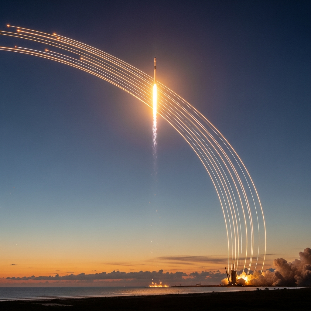
The RESILIENCE lander, part of Japan-based ispace’s ambitious second attempt at a lunar touchdown, was launched on January 15 aboard a SpaceX rocket. It aimed for a soft landing on June 5, 2025, UTC. However, the mission experienced a critical anomaly during its final descent, resulting in a forceful impact with the lunar surface in the Mare Frigoris region. This incident marks ispace’s second unsuccessful attempt at a lunar landing, following a similar outcome in April 2023. Preliminary assessments from ispace have suggested a potential issue with the lander’s laser rangefinder, a crucial instrument for determining altitude during landing, may have contributed to the failure.
Locating the Impact Site from Orbit
The search for the crash site began swiftly. Initially, confirmation of the hard landing was achieved through analysis of images captured by the Indian Space Research Organisation’s (ISRO) Chandrayaan-2 orbiter by amateur astronomer Shanmuga Subramanian. Equipped with a high-resolution camera (OHRC), Chandrayaan-2 provided early visual evidence of the impact scar and debris scatter.
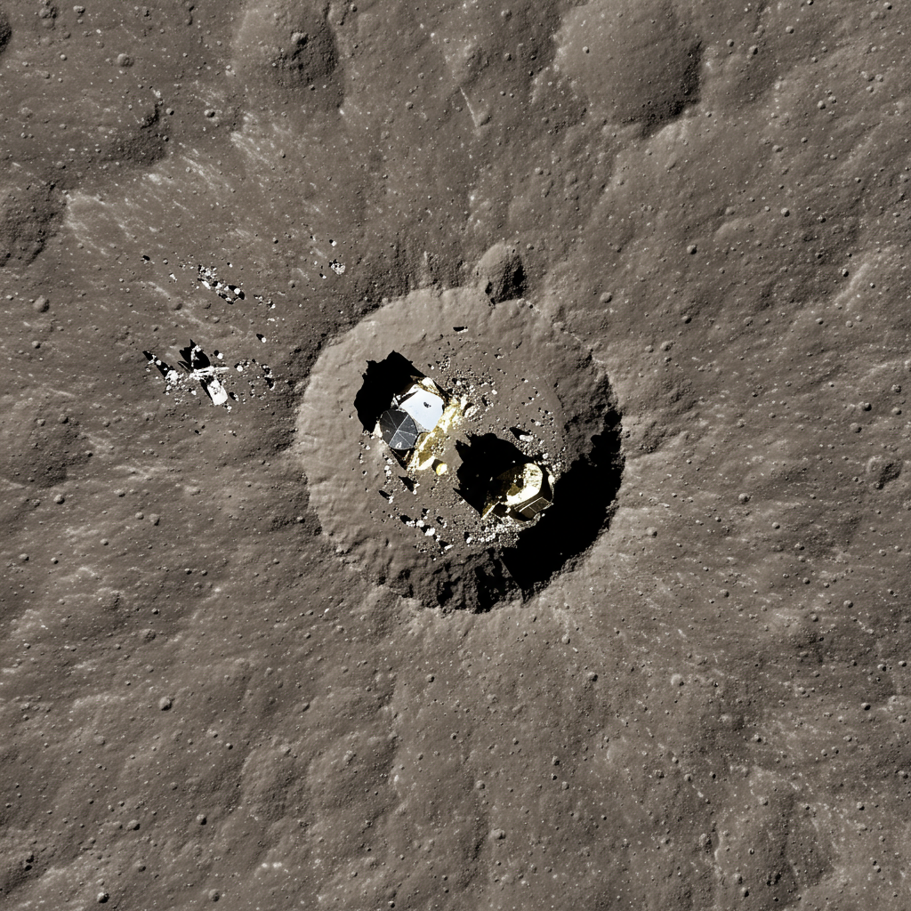
Just days later, on June 11, NASA’s powerful Lunar Reconnaissance Orbiter (LRO) further confirmed and detailed the site. Using its high-resolution Narrow Angle Camera (part of the LROC instrument suite) from an altitude of about 50 miles (approximately 80 kilometers), LRO pinpointed the exact location of impact.
What LRO Saw: A Scar on the Moon
The images from LRO’s LROC reveal distinct features on the lunar surface consistent with a high-velocity impact. The most prominent feature is a dark smudge, clearly visible at the center of the impact area. This dark patch was created when the lander struck the ground, forcefully kicking up and displacing lunar regolith – the layer of dust, soil, and broken rock covering the Moon’s surface. Debris from the lander was also scattered outwards by the collision.
Surrounding the dark smudge is a more subtle, bright halo. This halo is believed to be the result of lower-angle regolith particles being scoured across the delicate surface during the explosive impact, creating a lighter-toned ring. The size and appearance of this ejecta pattern offer strong evidence of the forceful collision. An animation comparing images of the site before and after the impact clearly highlights these changes over an area spanning roughly 2 miles (3.2 kilometers).
Geological Context: Mare Frigoris
The impact occurred within Mare Frigoris, or the “Sea of Cold,” a vast volcanic plain located north of the Moon’s equator. This ancient region, formed over 3.5 billion years ago by massive basalt eruptions, is also characterized by large-scale wrinkle ridges created by the Moon’s contraction. Documenting new features like this impact site within such geologically significant terrain is valuable for planetary scientists studying the Moon’s history and surface processes. The dark impact spot and its surrounding halo are expected to remain visible for decades, serving as a long-term research target.
LRO’s Crucial Role in Lunar Exploration
NASA’s Lunar Reconnaissance Orbiter, managed by Goddard Space Flight Center, has been a cornerstone of lunar science since its launch on June 18, 2009. With its suite of seven powerful instruments, LRO has amassed an invaluable treasure trove of data, greatly expanding humanity’s understanding of its nearest celestial neighbor.
Observing events like the RESILIENCE impact site is part of LRO’s ongoing mission. These images not only confirm the outcome of commercial missions but also provide crucial data points for understanding impact mechanics on airless bodies like the Moon. By documenting features ranging from historic Apollo landing sites to recent mission failures, LRO provides an impartial, long-term record of activity on the lunar surface, supporting both scientific analysis and future mission planning.
As NASA increases its partnerships with private companies through initiatives like the Commercial Lunar Payload Services (CLPS) program, successful and unsuccessful landing attempts are becoming more frequent. Each mission, regardless of its outcome, yields vital data that contributes to the collective knowledge base, paving the way for future successes as humanity and its commercial partners continue their return to and exploration of the Moon.